Geolocate

Clapham topographic map

Click on the map to display elevation.

About this map
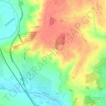
Name: Clapham topographic map, elevation, terrain.

Location: Clapham, Bedford, England, United Kingdom (52.15650 -0.51512 52.19239 -0.46670)

Average elevation: 60 m

Minimum elevation: 30 m

Maximum elevation: 90 m

Gear up for your next adventure:

🥾Trekking Poles - Adjustable trekking poles to reduce knee stress and improve stability
🥾Mountain Hiking Shoes - Shoes with superior grip for mountainous terrain
🧭GPS Handheld Device - Reliable GPS navigation for outdoor adventures
🧼Travel Hand Sanitizer - Keep hands clean when water is scarce
🧥Softshell Hiking Jacket - The perfect balance of wind protection and breathability

As an Amazon Associate, this site earns from qualifying purchases at no extra cost to you.