
Moose River topographic map
Interactive map
Click on the map to display elevation.
About this map
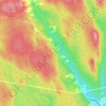
Name: Moose River topographic map, elevation, terrain.
Average elevation: 197 m
Minimum elevation: 117 m
Maximum elevation: 265 m
Municipality of Pictou County trails, hiking, mountain biking, running and outdoor activities
Other topographic maps
Click on a map to view its topography, its elevation and its terrain.
Lansdowne Lake
Canada > Nova Scotia > Municipality of Pictou County > New Lairg
Average elevation: 160 m
MacKays Corner
Canada > Nova Scotia > Municipality of Pictou County > Caribou River
Average elevation: 10 m