
Saint-Fulgence topographic map
Interactive map
Click on the map to display elevation.
About this map
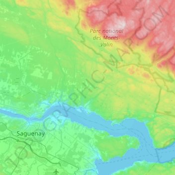
Name: Saint-Fulgence topographic map, elevation, terrain.
Average elevation: 243 m
Minimum elevation: 0 m
Maximum elevation: 975 m
Routes: Le Fjord-du-Saguenay GPS tracks, routes, trails, hikes
Other topographic maps
Click on a map to view its topography, its elevation and its terrain.
Kenogami Lake
Canada > Quebec > Le Fjord-du-Saguenay > Saguenay
Kenogami lake is a long lake in the Saguenay–Lac-Saint-Jean region of south-central Quebec, Canada. Situated at an altitude of 150 m (490 ft), the lake is 27 km (17 mi) long and 11 to 102 m (36 to 335 ft) deep. "Kénogami" means "long lake" in the Montagnais dialect and was originally used to refer to…
Average elevation: 200 m
Montagne Charles
Canada > Quebec > Le Fjord-du-Saguenay > Saint-David-de-Falardeau
Average elevation: 235 m