Geolocate

Blacksville topographic map

Click on the map to display elevation.

About this map

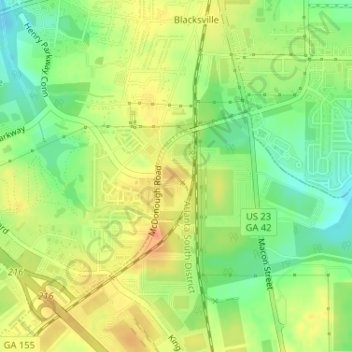
Name: Blacksville topographic map, elevation, terrain.

Location: Blacksville, Henry County, Georgia, United States (33.41812 -84.15255 33.42533 -84.14885)

Average elevation: 263 m

Minimum elevation: 239 m

Maximum elevation: 285 m

Other topographic maps

Click on a map to view its topography, its elevation and its terrain.

Whitehouse

United States > Georgia > Henry County

Average elevation: 230 m

Flippen

United States > Georgia > Henry County

Average elevation: 252 m

Fortson

United States > Georgia > Henry County > Hampton

Average elevation: 259 m

McDonough

United States > Georgia > Henry County > McDonough

Average elevation: 248 m

Ola

United States > Georgia > Henry County

Average elevation: 230 m

Kelleytown

United States > Georgia > Henry County

Average elevation: 220 m

Weems Lake

United States > Georgia > Henry County

Average elevation: 245 m

Hiram Cook Lake

United States > Georgia > Henry County

Average elevation: 248 m

Gear up for your next adventure:

🧣Evaporative Cooling Towel - Beat the heat during intense summer climbs
🦟Insect Repellent - Keep mosquitoes and black flies away in wooded areas
🧥Waterproof Hiking Jacket - Protect yourself from rain and wind while hiking
💡LED Headlamp - Hands-free illumination for night hiking and camping
🧼Travel Hand Sanitizer - Keep hands clean when water is scarce

As an Amazon Associate, this site earns from qualifying purchases at no extra cost to you.