
Saint-Claude topographic map
Interactive map
Click on the map to display elevation.
About this map
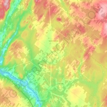
Name: Saint-Claude topographic map, elevation, terrain.
Location: Saint-Claude, Le Val-Saint-François, Estrie, Quebec, Canada (45.56499 -72.05918 45.71500 -71.83189)
Average elevation: 233 m
Minimum elevation: 114 m
Maximum elevation: 369 m
Le Val-Saint-François trails, hiking, mountain biking, running and outdoor activities
Other topographic maps
Click on a map to view its topography, its elevation and its terrain.
Richmond
Canada > Quebec > Le Val-Saint-François > Ville de Richmond > Richmond
Average elevation: 189 m