Geolocate

McCourts Corner topographic map

Click on the map to display elevation.

About this map

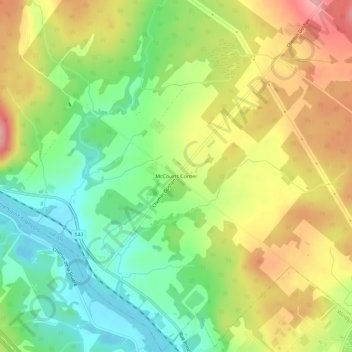
Name: McCourts Corner topographic map, elevation, terrain.

Location: McCourts Corner, Val-Joli, Le Val-Saint-François, Estrie, Quebec, J1S 2E1, Canada (45.58134 -72.03617 45.62134 -71.99617)

Average elevation: 179 m

Minimum elevation: 117 m

Maximum elevation: 253 m

Le Val-Saint-François trails, hiking, mountain biking, running and outdoor activities

Gear up for your next adventure:

Lightweight Camping Tent - Portable shelter optimized for Canadian backcountry camping
🧥Softshell Jacket - Windproof and breathable jacket for hiking
🥾Trekking Poles - Adjustable trekking poles to reduce knee stress and improve stability
Bushcraft Tarp - Versatile emergency shelter or gear protection
🥾Trail Hiking Shoes - Durable shoes designed for rugged trails

As an Amazon Associate, this site earns from qualifying purchases at no extra cost to you.