Geolocate

Astwick topographic map

Click on the map to display elevation.

About this map

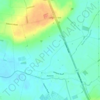
Name: Astwick topographic map, elevation, terrain.

Location: Astwick, Central Bedfordshire, England, United Kingdom (52.02956 -0.24535 52.04720 -0.21480)

Average elevation: 50 m

Minimum elevation: 37 m

Maximum elevation: 79 m

Gear up for your next adventure:

🥾Mountain Hiking Boots - High-traction boots for rocky terrain
🧴Outdoor Sunscreen - High SPF protection for high-altitude UV exposure
🚲MTB Frame Bag - Carry tools and maps directly on your bicycle frame
🎒Fully Waterproof Backpack - Total protection for photography gear and electronics
🥾Durable Hiking Shoes - Long-lasting shoes for frequent hiking

As an Amazon Associate, this site earns from qualifying purchases at no extra cost to you.