Geolocate

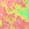
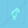
Lottefors topographic map

Click on the map to display elevation.

About this map

Name: Lottefors topographic map, elevation, terrain.

Location: Lottefors, Bollnäs kommun, Gävleborg County, Sweden (61.39932 16.38747 61.43932 16.42747)

Average elevation: 125 m

Minimum elevation: 81 m

Maximum elevation: 241 m

Other topographic maps

Click on a map to view its topography, its elevation and its terrain.
Gävle

Sweden > Gävleborg County

Average elevation: 28 m

Gävle

Sweden > Gävleborg County

Average elevation: 28 m

Disan

Sweden > Gävleborg County

Average elevation: 43 m

Gävle kommun

Sweden > Gävleborg County

Average elevation: 61 m

Hamra

Sweden > Gävleborg County

Average elevation: 437 m

Hudiksvalls kommun

Sweden > Gävleborg County

Average elevation: 95 m

Ovanåkers kommun

Sweden > Gävleborg County

Average elevation: 269 m

Söderhamns kommun

Sweden > Gävleborg County

Average elevation: 67 m

Ljusdals kommun

Sweden > Gävleborg County

Average elevation: 315 m

Gnarp District

Sweden > Gävleborg County

Average elevation: 32 m

Gran

Sweden > Gävleborg County > Gnarp District

Average elevation: 0 m

Hamra

Sweden > Gävleborg County

Average elevation: 437 m

Hamra

Sweden > Gävleborg County

Average elevation: 437 m

Gear up for your next adventure:

⛺Tent Footprint - Protect tent floor and increase durability
🧥Thermal Fleece Jacket - Versatile insulation for changing mountain temperatures
🥾Approach Boots - Comfortable boots for hiking and climbing approaches
🧳Compression Sacks - Maximize space in your backpack by shrinking gear
💧Hydration Pack - Hands-free hydration system for long hikes

As an Amazon Associate, this site earns from qualifying purchases at no extra cost to you.