Geolocate

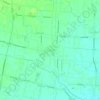
Agna topographic map

Click on the map to display elevation.

About this map

Name: Agna topographic map, elevation, terrain.

Location: Agna, Padova, Veneto, 35021, Italia (45.14690 11.92575 45.20284 12.02186)

Average elevation: 1 m

Minimum elevation: -4 m

Maximum elevation: 7 m

Other topographic maps

Click on a map to view its topography, its elevation and its terrain.
Rustega

Italia > Veneto > Padova > Camposampiero

Average elevation: 21 m

Monte Venda

Italia > Veneto > Padova > Vo'

Average elevation: 300 m

Onara

Italia > Veneto > Padova

Average elevation: 38 m

Perarolo

Italia > Veneto > Padova > Vigonza

Average elevation: 9 m

Campolongo

Italia > Veneto > Padova > Vo'

Average elevation: 121 m

Santa Maria di Non

Italia > Veneto > Padova

Average elevation: 20 m

Monte Rusta

Italia > Veneto > Padova > Faedo

Average elevation: 132 m

Villa

Italia > Veneto > Padova

Average elevation: 122 m

Caselle

Italia > Veneto > Padova > Selvazzano Dentro

Average elevation: 15 m

Ca' Molin

Italia > Veneto > Padova > Bovolenta

Average elevation: 2 m

Gear up for your next adventure:

🍽️Titanium Camping Spork - Ultralight and indestructible eating utensil
🧭GPS Outdoor Watch - Smart watch for navigation and fitness tracking in nature
🛌Insulated Sleeping Pad - Critical thermal barrier between you and the cold ground
🧢Outdoor Cap - Protective cap for sun and rain during hikes
🛶Waterproof Dry Bags - Keep electronics and clothes dry during river crossings

As an Amazon Associate, this site earns from qualifying purchases at no extra cost to you.