Geolocate

Cougie topographic map

Click on the map to display elevation.

About this map

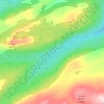
Name: Cougie topographic map, elevation, terrain.

Location: Cougie, Highland, Scotland, United Kingdom (57.22715 -4.93582 57.26715 -4.89582)

Average elevation: 397 m

Minimum elevation: 238 m

Maximum elevation: 631 m

Other topographic maps

Click on a map to view its topography, its elevation and its terrain.

Loch Ness

United Kingdom > Scotland > Highland > Dores

Average elevation: 340 m

Gear up for your next adventure:

Family Camping Tent - Spacious tent suitable for family camping trips
💧Hydration Pack - Hands-free hydration system for long hikes
🧥Softshell Hiking Jacket - The perfect balance of wind protection and breathability
🥾Trekking Poles - Adjustable trekking poles to reduce knee stress and improve stability
🥾Waterproof Hiking Shoes - Durable shoes for wet and rugged trails

As an Amazon Associate, this site earns from qualifying purchases at no extra cost to you.