Geolocate

Khala Muhammad topographic map

Click on the map to display elevation.

About this map

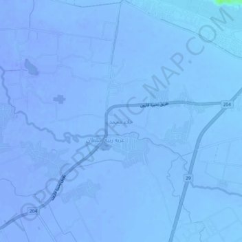
Name: Khala Muhammad topographic map, elevation, terrain.

Location: Khala Muhammad, Faiyum, Egypt (29.48099 30.84462 29.52099 30.88462)

Average elevation: -36 m

Minimum elevation: -44 m

Maximum elevation: 8 m

Other topographic maps

Click on a map to view its topography, its elevation and its terrain.

First Al Nagarin

Egypt > Faiyum

Average elevation: 23 m

Wadi Al Rayyan National Park

Egypt > Faiyum

Average elevation: 47 m

Faiyum Oasis

Egypt > Faiyum

Average elevation: 32 m

Watermelon Valley

Egypt > Faiyum

Average elevation: -15 m

First Al Nagarin

Egypt > Faiyum

Average elevation: 23 m

Youssef Al Sediq City

Egypt > Faiyum

Average elevation: 7 m

الكعابي الجديدة

Egypt > Faiyum

Average elevation: 19 m

New Al Fayoum City

Egypt > Faiyum

Average elevation: 59 m

Lake Qaroun

Egypt > Faiyum

Average elevation: 33 m

Youssef Al Sediq City

Egypt > Faiyum

Average elevation: 7 m

Gear up for your next adventure:

🔦LED Flashlight - Powerful and long-lasting flashlight for camping and emergencies
🥾Approach Boots - Comfortable boots for hiking and climbing approaches
🔋Emergency Crank Radio - Weather alerts and power without needing batteries
🧥Waterproof Jacket - Lightweight rain jackets for hiking and outdoor activities
🛏️Sleeping Bag - Warm and compact sleeping bags for outdoor camping

As an Amazon Associate, this site earns from qualifying purchases at no extra cost to you.