Geolocate

Tomtit Lake topographic map

Interactive map

Click on the map to display elevation.

About this map

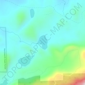
Name: Tomtit Lake topographic map, elevation, terrain.

Location: Tomtit Lake, Snohomish County, Washington, United States (47.81691 -121.78991 47.82148 -121.78428)

Average elevation: 272 m

Minimum elevation: 148 m

Maximum elevation: 779 m

Other topographic maps

Click on a map to view its topography, its elevation and its terrain.

Index

United States > Washington > Snohomish County

Average elevation: 366 m

Sultan

United States > Washington > Snohomish County

Average elevation: 78 m

Pass Lake

United States > Washington > Snohomish County

Average elevation: 1,167 m

Edmonds

United States > Washington > Snohomish County

Average elevation: 44 m

Marysville

United States > Washington > Snohomish County

The city's topography varies from the low-lying downtown, located along the banks of Ebey Slough 5 feet (1.5 m) above sea level, rising to 160 feet (49 m) near Smokey Point and over 465 feet (142 m) in the eastern highlands. Marysville sits in the watershed of two major creeks, Quilceda Creek and Allen Creek,…

Average elevation: 72 m

Everett

United States > Washington > Snohomish County

Average elevation: 69 m

Monroe

United States > Washington > Snohomish County

The city lies at the eastern end of the Snohomish River floodplain, with elevations that range from 40 to 210 feet (12 to 64 m). The south and east edges of the city along the Skykomish River are within a 100-year flood hazard zone and also include habitats for migratory birds and game animals. The residential…

Average elevation: 49 m