
Llaneces topographic map
Interactive map
Click on the map to display elevation.
About this map
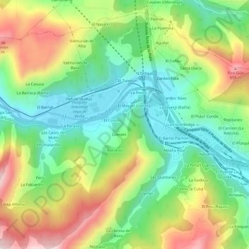
Name: Llaneces topographic map, elevation, terrain.
Location: Llaneces, Asturias, 33669, España (43.25070 -5.83649 43.29070 -5.79649)
Average elevation: 368 m
Minimum elevation: 159 m
Maximum elevation: 694 m
Other topographic maps
Click on a map to view its topography, its elevation and its terrain.