Geolocate

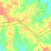
Earles Grove topographic map

Click on the map to display elevation.

About this map

Name: Earles Grove topographic map, elevation, terrain.

Location: Earles Grove, Oconee County, South Carolina, United States (34.54677 -83.01182 34.58677 -82.97182)

Average elevation: 257 m

Minimum elevation: 211 m

Maximum elevation: 290 m

Other topographic maps

Click on a map to view its topography, its elevation and its terrain.

Seneca

United States > South Carolina > Oconee County

Average elevation: 265 m

Walhalla

United States > South Carolina > Oconee County

Average elevation: 296 m

Salem

United States > South Carolina > Oconee County

Average elevation: 316 m

Seneca

United States > South Carolina > Oconee County

Average elevation: 265 m

Salem

United States > South Carolina > Oconee County

Average elevation: 316 m

Seneca

United States > South Carolina > Oconee County

Average elevation: 265 m

Gear up for your next adventure:

🛶Kayak Accessories - Essential gear for safe and fun kayaking adventures
🧥Ultralight Puffy Jacket - Maximum warmth that packs down to the size of an orange
🥾Hiking Gaiters - Protect legs and shoes from mud, snow, and debris
💡Portable Camping Lamp - Rechargeable lamp for campsite lighting
🔋Solar Power Bank - Keep your GPS and devices charged during long outdoor trips

As an Amazon Associate, this site earns from qualifying purchases at no extra cost to you.