

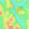
Cheilly-lès-Maranges topographic map
Click on the map to display elevation.
About this map

Name: Cheilly-lès-Maranges topographic map, elevation, terrain.
Average elevation: 281 m
Minimum elevation: 212 m
Maximum elevation: 477 m
Other topographic maps
Click on a map to view its topography, its elevation and its terrain.

Commune
France > Bourgogne-Franche-Comté > Saône-et-Loire > Martigny-le-Comte
Average elevation: 353 m

Autun
France > Bourgogne-Franche-Comté > Saône-et-Loire > Autun > Autun
Le climat de la ville est caractérisé par des influences méridionales plus marquées que dans le reste du Morvan, notamment du fait de l'altitude inférieure à quatre cents mètres. La pluviométrie est modérée (inférieure à 900 mm/an sur trente ans).
Average elevation: 399 m


Château de Pierreclos
France > Bourgogne-Franche-Comté > Saône-et-Loire > Pierreclos
Average elevation: 335 m

Les Trèches
France > Bourgogne-Franche-Comté > Saône-et-Loire > Saint-Yan > Les Trèches
Average elevation: 257 m

Meix Tuzon
France > Bourgogne-Franche-Comté > Saône-et-Loire > Sainte-Croix-en-Bresse > Meix Tuzon
Average elevation: 200 m


Le Paradis
France > Bourgogne-Franche-Comté > Saône-et-Loire > Saint-Martin-en-Bresse
Average elevation: 196 m

Château de Brandon
France > Bourgogne-Franche-Comté > Saône-et-Loire > Saint-Pierre-de-Varennes
Average elevation: 420 m


La Croix Rouge
France > Bourgogne-Franche-Comté > Saône-et-Loire > Saint-Germain-du-Bois
Average elevation: 201 m

Loyse
France > Bourgogne-Franche-Comté > Saône-et-Loire > La Chapelle-de-Guinchay
Average elevation: 197 m


Seugny
France > Bourgogne-Franche-Comté > Saône-et-Loire > Louhans-Châteaurenaud
Average elevation: 189 m

Les Longs Bois
France > Bourgogne-Franche-Comté > Saône-et-Loire > Saint-Forgeot
Average elevation: 305 m

Les Rues
France > Bourgogne-Franche-Comté > Saône-et-Loire > Fleury-la-Montagne
Average elevation: 376 m

Le Rousset
France > Bourgogne-Franche-Comté > Saône-et-Loire > Le Rousset-Marizy
Average elevation: 403 m


Les Combes du Haut
France > Bourgogne-Franche-Comté > Saône-et-Loire > Montcenis
Average elevation: 409 m


La Piat
France > Bourgogne-Franche-Comté > Saône-et-Loire > Saint-Amour-Bellevue
Average elevation: 243 m

Balme de Rochebin
France > Bourgogne-Franche-Comté > Saône-et-Loire > Azé > Montchanin
Average elevation: 305 m

Les Rompas
France > Bourgogne-Franche-Comté > Saône-et-Loire > Saint-Romain-sous-Gourdon
Average elevation: 361 m

Le Colombier
France > Bourgogne-Franche-Comté > Saône-et-Loire > Navour-sur-Grosne
Average elevation: 347 m


Les Vernes
France > Bourgogne-Franche-Comté > Saône-et-Loire > Saint-Bonnet-en-Bresse
Average elevation: 190 m

Les Crozes
France > Bourgogne-Franche-Comté > Saône-et-Loire > Saint-Igny-de-Roche
Average elevation: 421 m


Frêne
France > Bourgogne-Franche-Comté > Saône-et-Loire > Lournand > Sous Lourdon
Average elevation: 352 m


Martoret
France > Bourgogne-Franche-Comté > Saône-et-Loire > Saint-Maurice-de-Satonnay
Average elevation: 228 m


Robin
France > Bourgogne-Franche-Comté > Saône-et-Loire > Saint-Martin-de-Lixy
Average elevation: 350 m


Les Brosses
France > Bourgogne-Franche-Comté > Saône-et-Loire > Davayé > Les Brosses
Average elevation: 277 m

Les Poncétys
France > Bourgogne-Franche-Comté > Saône-et-Loire > Davayé > Les Poncétys
Average elevation: 283 m


La Garde
France > Bourgogne-Franche-Comté > Saône-et-Loire > Navour-sur-Grosne
Average elevation: 349 m


Les Tréaux
France > Bourgogne-Franche-Comté > Saône-et-Loire > La Grande-Verrière
Average elevation: 422 m


Estours
France > Bourgogne-Franche-Comté > Saône-et-Loire > Crêches-sur-Saône
Average elevation: 186 m


La Ferdière du Bas
France > Bourgogne-Franche-Comté > Saône-et-Loire > Navour-sur-Grosne
Average elevation: 363 m


La Brancionne
France > Bourgogne-Franche-Comté > Saône-et-Loire > Crêches-sur-Saône
Average elevation: 193 m


Brancion
France > Bourgogne-Franche-Comté > Saône-et-Loire > Martailly-lès-Brancion
Average elevation: 303 m


Les Agrots
France > Bourgogne-Franche-Comté > Saône-et-Loire > Fleury-la-Montagne
Average elevation: 379 m


Les Justices
France > Bourgogne-Franche-Comté > Saône-et-Loire > Saint-Julien-de-Jonzy
Average elevation: 418 m

Les Baudys
France > Bourgogne-Franche-Comté > Saône-et-Loire > Berzé-le-Châtel
Average elevation: 419 m

Le Reuil
France > Bourgogne-Franche-Comté > Saône-et-Loire > Mont-Saint-Vincent
Average elevation: 459 m


Les Branles
France > Bourgogne-Franche-Comté > Saône-et-Loire > Curtil-sous-Buffières
Average elevation: 377 m


Le Montsacc
France > Bourgogne-Franche-Comté > Saône-et-Loire > Saint-Christophe-en-Brionnais
Average elevation: 431 m


Le Potet
France > Bourgogne-Franche-Comté > Saône-et-Loire > Matour > Le Potet
Average elevation: 534 m


Grolier
France > Bourgogne-Franche-Comté > Saône-et-Loire > Pierreclos > Grolier
Average elevation: 361 m

Le Crot au Meunier
France > Bourgogne-Franche-Comté > Saône-et-Loire > La Grande-Verrière
Average elevation: 513 m