
Myunda topographic map
Click on the map to display elevation.
About this map
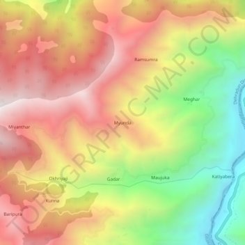
Name: Myunda topographic map, elevation, terrain.
Location: Myunda, Chakrata, Dehradun District, Uttarakhand, India (30.68124 78.02963 30.72124 78.06963)
Average elevation: 1,581 m
Minimum elevation: 880 m
Maximum elevation: 2,174 m
Other topographic maps
Click on a map to view its topography, its elevation and its terrain.