
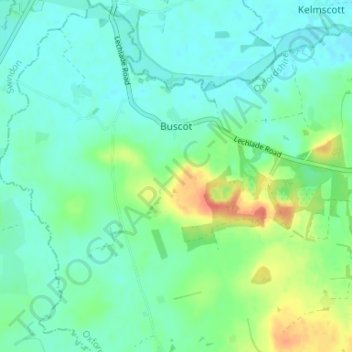
Buscot topographic map
Click on the map to display elevation.
About this map
Name: Buscot topographic map, elevation, terrain.
Average elevation: 81 m
Minimum elevation: 68 m
Maximum elevation: 115 m
Other topographic maps
Click on a map to view its topography, its elevation and its terrain.
Lamborough Hill
United Kingdom > England > Oxfordshire > Vale of White Horse > Wootton
Average elevation: 92 m
Boars Hill
United Kingdom > England > Oxfordshire > Vale of White Horse > Wootton
Average elevation: 106 m
The Spinney
United Kingdom > England > Oxfordshire > Vale of White Horse > Kingston Bagpuize
Average elevation: 77 m
Kingston Bagpuize
United Kingdom > England > Oxfordshire > Vale of White Horse
Average elevation: 76 m
Carswell Marsh
United Kingdom > England > Oxfordshire > Vale of White Horse > Buckland
Average elevation: 80 m
Sutton Pools
United Kingdom > England > Oxfordshire > Vale of White Horse > Abingdon > Sutton Courtenay
Average elevation: 54 m
Sutton Wick
United Kingdom > England > Oxfordshire > Vale of White Horse > Abingdon > Drayton
Average elevation: 57 m
Little Lews
United Kingdom > England > Oxfordshire > Vale of White Horse > Ardington
Average elevation: 183 m
White Horse Hill
United Kingdom > England > Oxfordshire > Vale of White Horse
Average elevation: 184 m
Badger's Well
United Kingdom > England > Oxfordshire > Vale of White Horse > Appleton
Average elevation: 79 m
Milton Heights
United Kingdom > England > Oxfordshire > Vale of White Horse > Milton
Average elevation: 72 m