Geolocate

Driftpile topographic map

Click on the map to display elevation.

About this map

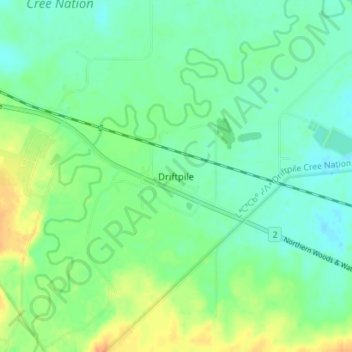
Name: Driftpile topographic map, elevation, terrain.

Location: Driftpile, Division No. 17, Alberta, Canada (55.32296 -115.79873 55.36296 -115.75873)

Average elevation: 590 m

Minimum elevation: 578 m

Maximum elevation: 612 m

Division No. 17 trails, hiking, mountain biking, running and outdoor activities

Other topographic maps

Click on a map to view its topography, its elevation and its terrain.

Lesser Slave Lake

Canada > Alberta > Division No. 17

Average elevation: 705 m

Gear up for your next adventure:

🔦LED Headtorch - Bright and durable light for night activities
🥾Waterproof Hiking Shoes - Durable shoes for wet and rugged trails
🥾Hiking Shorts - Breathable shorts suitable for summer hikes
🧴Sunscreen SPF - Broad-spectrum sunscreen for outdoor activities
🚲Bike Repair Kit - Essential tools for on-trail mechanical issues

As an Amazon Associate, this site earns from qualifying purchases at no extra cost to you.