Geolocate

North Fambridge topographic map

Click on the map to display elevation.

About this map

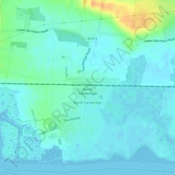
Name: North Fambridge topographic map, elevation, terrain.

Location: North Fambridge, Maldon, Essex, England, United Kingdom (51.63515 0.65344 51.66131 0.69382)

Average elevation: 7 m

Minimum elevation: -2 m

Maximum elevation: 35 m

Other topographic maps

Click on a map to view its topography, its elevation and its terrain.

Totham Hill

United Kingdom > England > Essex > Maldon

Average elevation: 48 m

Steeple

United Kingdom > England > Essex > Maldon

Average elevation: 14 m

Great Cob Island

United Kingdom > England > Essex > Maldon

Average elevation: 0 m

Broad Street Green

United Kingdom > England > Essex > Maldon > Heybridge

Average elevation: 18 m

Osea Island

United Kingdom > England > Essex > Maldon

Average elevation: 1 m

Weymarks Beach

United Kingdom > England > Essex > Maldon

Average elevation: 1 m

Ramsey Island

United Kingdom > England > Essex > Maldon > St Lawrence

Average elevation: 3 m

Gear up for your next adventure:

💡Compact LED Flashlight - Powerful and portable flashlight for outdoor use
🧢Beanie Hat - Keep your head warm in cold weather
🥾Light Trekking Boots - Supportive boots for multi-day treks
🧥Waterproof Jacket - Lightweight rain jackets for hiking and outdoor activities
🎒Hiking Backpack - Lightweight and ergonomic backpacks for day hikes or multi-day treks

As an Amazon Associate, this site earns from qualifying purchases at no extra cost to you.