Geolocate

Macedonia topographic map

Click on the map to display elevation.

About this map

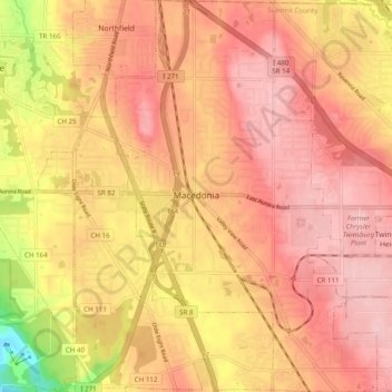
Name: Macedonia topographic map, elevation, terrain.

Location: Macedonia, Summit County, Ohio, 44056, United States (41.27669 -81.53071 41.35026 -81.46332)

Average elevation: 310 m

Minimum elevation: 199 m

Maximum elevation: 361 m

Other topographic maps

Click on a map to view its topography, its elevation and its terrain.

Boston

United States > Ohio > Summit County

Average elevation: 245 m

Greensburg

United States > Ohio > Summit County > Green

Average elevation: 358 m

Metz

United States > Ohio > Summit County > Stow

Average elevation: 318 m

Copley

United States > Ohio > Summit County

Average elevation: 318 m

Copley

United States > Ohio > Summit County

Average elevation: 318 m

Sagamore Hills

United States > Ohio > Summit County

Average elevation: 264 m

Maple Grove Park

United States > Ohio > Summit County > Hudson

Average elevation: 316 m

Decker Park

United States > Ohio > Summit County > Barberton

Average elevation: 304 m

Myersville

United States > Ohio > Summit County > Green

Average elevation: 342 m

Metz

United States > Ohio > Summit County > Stow

Average elevation: 318 m

Gear up for your next adventure:

🧦Hiking Socks - Moisture-wicking and comfortable socks for long hikes
🧢Sun Hat - Wide-brim hat for sun protection
🐕Hiking Dog Pack - Let your canine companion carry their own water and food
🦯Trekking Poles - Reduced impact on joints for steep topographic climbs
🧥Waterproof Pants - Keep dry during rainy hiking conditions

As an Amazon Associate, this site earns from qualifying purchases at no extra cost to you.