Geolocate

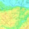
Fountain topographic map

Click on the map to display elevation.

About this map

Name: Fountain topographic map, elevation, terrain.

Location: Fountain, Pitt County, North Carolina, United States (35.66341 -77.64502 35.67917 -77.61492)

Average elevation: 31 m

Minimum elevation: -53 m

Maximum elevation: 39 m

Other topographic maps

Click on a map to view its topography, its elevation and its terrain.
Staton

United States > North Carolina > Pitt County

Average elevation: 12 m

Twin Creek

United States > North Carolina > Pitt County

Average elevation: 16 m

Stokes

United States > North Carolina > Pitt County

Average elevation: 15 m

Higgs

United States > North Carolina > Pitt County > Greenville

Average elevation: 15 m

Higgs

United States > North Carolina > Pitt County > Greenville

Average elevation: 15 m

Gear up for your next adventure:

☕Camping Coffee Maker - Brew fresh coffee anywhere on the topographic map
⛺Camping Tent - Weather-resistant tents suitable for 2 to 6 people
🧦Merino Wool Socks - Moisture-wicking comfort for long-distance hiking
🧴Bear Spray Holster - Quick-access carry for essential Canadian wilderness safety
🩹Moleskin Blister Pads - Direct protection for painful foot pressure points

As an Amazon Associate, this site earns from qualifying purchases at no extra cost to you.