Geolocate

Hällevik topographic map

Click on the map to display elevation.
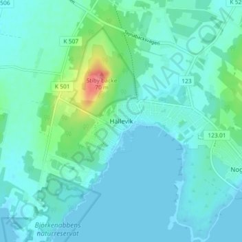
About this map

Name: Hällevik topographic map, elevation, terrain.

Location: Hällevik, Sölvesborgs kommun, Blekinge County, 294 71, Sweden (55.99378 14.67697 56.03378 14.71697)

Average elevation: 11 m

Minimum elevation: -2 m

Maximum elevation: 68 m

Other topographic maps

Click on a map to view its topography, its elevation and its terrain.

Sturkö

Sweden > Blekinge County > Sturkö

Average elevation: 4 m

Ronneby kommun

Sweden > Blekinge County

Average elevation: 45 m

Sölvesborgs kommun

Sweden > Blekinge County

Average elevation: 9 m

Gear up for your next adventure:

🥾Mountain Trail Shoes - High-traction shoes for mountain trails
🧥Waterproof Pants - Keep dry during rainy hiking conditions
🧊Insulated Water Bottle - Keeps drinks cold in summer and prevents freezing in winter
🔥Emergency Fire Starter - Reliable ignition source for all weather conditions
🧤Insulated Winter Gloves - Heavy-duty protection for sub-zero Canadian adventures

As an Amazon Associate, this site earns from qualifying purchases at no extra cost to you.