Geolocate

Ashland topographic map

Click on the map to display elevation.

About this map
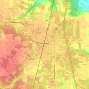
Name: Ashland topographic map, elevation, terrain.

Location: Ashland, Hanover County, Virginia, 23005, United States (37.72453 -77.50056 37.79207 -77.44640)

Average elevation: 66 m

Minimum elevation: 28 m

Maximum elevation: 82 m

Gear up for your next adventure:

🧶550 Survival Paracord - Versatile utility cord for emergency repairs and rigging
🥾Trail Hiking Socks - Comfortable socks to prevent blisters and fatigue
🏃Hydration Running Vest - Carry water and maps close to your body for speed
🧭GPS Tracker - Track your location in remote areas safely
🥾Durable Hiking Shoes - Long-lasting shoes for frequent hiking

As an Amazon Associate, this site earns from qualifying purchases at no extra cost to you.