Geolocate

Stättared topographic map

Click on the map to display elevation.

About this map

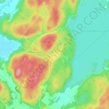
Name: Stättared topographic map, elevation, terrain.

Location: Stättared, Kungsbacka kommun, Halland County, 439 64, Sweden (57.31780 12.32081 57.35780 12.36081)

Average elevation: 65 m

Minimum elevation: 17 m

Maximum elevation: 147 m

Other topographic maps

Click on a map to view its topography, its elevation and its terrain.

Hallandsåsen

Sweden > Halland County

Average elevation: 70 m

Fäberga naturreservat

Sweden > Halland County > Halmstad > Ryd

Average elevation: 38 m

Halmstads kommun

Sweden > Halland County

Average elevation: 65 m

Hylte kommun

Sweden > Halland County

Average elevation: 145 m

Kungsbacka kommun

Sweden > Halland County

Average elevation: 41 m

Vendelsö

Sweden > Halland County

Average elevation: 2 m

Laholms kommun

Sweden > Halland County

Average elevation: 98 m

Gällarpesjön

Sweden > Halland County

Average elevation: 104 m

Bocksjö

Sweden > Halland County

Average elevation: 75 m

Tjolöholms slott

Sweden > Halland County

Average elevation: 3 m

Varbergs kommun

Sweden > Halland County

Average elevation: 35 m

Gear up for your next adventure:

🚲MTB Frame Bag - Carry tools and maps directly on your bicycle frame
Bushcraft Tarp - Versatile emergency shelter or gear protection
🎒Hiking Daypack - Lightweight and durable backpacks for day trips and excursions
🔭Compact Monocular - One-handed bird watching and trail spotting
🧥Softshell Jacket - Windproof and breathable jacket for hiking

As an Amazon Associate, this site earns from qualifying purchases at no extra cost to you.