Geolocate

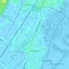
Bodegraven topographic map

Click on the map to display elevation.

About this map
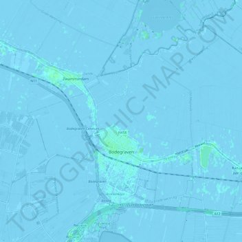
Name: Bodegraven topographic map, elevation, terrain.

Location: Bodegraven, Bodegraven-Reeuwijk, South Holland, Netherlands (52.06335 4.70473 52.12229 4.82539)

Average elevation: -1 m

Minimum elevation: -7 m

Maximum elevation: 4 m

Other topographic maps

Click on a map to view its topography, its elevation and its terrain.

Tweede Tol

Netherlands > South Holland > Dordrecht

Average elevation: 0 m

Gooland

Netherlands > South Holland > Nootdorp

Average elevation: -2 m

Langeraar

Netherlands > South Holland

Average elevation: -3 m

Meije

Netherlands > South Holland > Nieuwkoop

Average elevation: -2 m

Meijendel

Netherlands > South Holland > Wassenaar

Average elevation: 6 m

Weerestein

Netherlands > South Holland > Hillegom

Average elevation: 0 m

Botlek

Netherlands > South Holland

Average elevation: 3 m

Weerestein

Netherlands > South Holland > Hillegom

Average elevation: 0 m

Ankerpark

Netherlands > South Holland > Leiden

Average elevation: 3 m

Waalhaven

Netherlands > South Holland > Rotterdam

Average elevation: 3 m

Middelsluis

Netherlands > South Holland > Numansdorp

Average elevation: 0 m

Coepelduynen

Netherlands > South Holland > Katwijk

Average elevation: 4 m

Broekhuizen

Netherlands > South Holland > Gouda

Average elevation: -1 m

Het Park

Netherlands > South Holland > Rotterdam

Average elevation: 4 m

Gear up for your next adventure:

🛶Canoe Life Vest - Safety vest for water sports
🥾Hiking Gaiters - Protect legs and shoes from mud, snow, and debris
🧣Evaporative Cooling Towel - Beat the heat during intense summer climbs
🛌Down Sleeping Bag - Superior warmth-to-weight ratio for cold nights
🔋Solar Power Bank - Keep your GPS and devices charged during long outdoor trips

As an Amazon Associate, this site earns from qualifying purchases at no extra cost to you.