

Royton topographic map
Click on the map to display elevation.
Royton
Described in Samuel Lewis's A Topographical Dictionary of England (1848) as being in "aspect rather wild", Royton lies in a shallow valley amongst undulating land. The sources of the rivers Irk and Beal are to the northeast and east respectively. The Irk meanders southwesterly into Chadderton, and then onwards to Middleton into Manchester before uniting its waters with the River Irwell in Manchester city centre. The general slope of the land decreases in height away from the Pennines, from east to west, but reaches high points of 509 feet (155 m) at Tandle Hill and 825 feet (251 m) at the summit of Oldham Edge, a ridge of elevated land which leads to Oldham. The soils of the town are broadly sand with subsoils of clay.
About this map
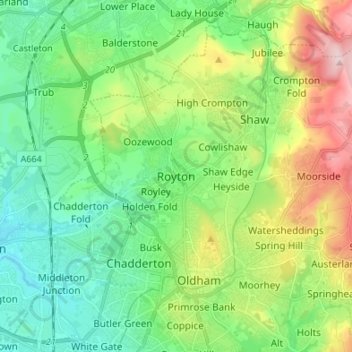
Name: Royton topographic map, elevation, terrain.
Average elevation: 181 m
Minimum elevation: 86 m
Maximum elevation: 393 m