Geolocate

Kattimoola topographic map

Click on the map to display elevation.

About this map

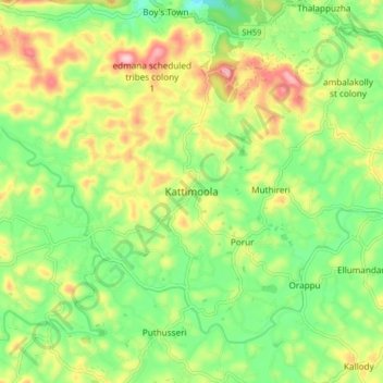
Name: Kattimoola topographic map, elevation, terrain.

Location: Kattimoola, Mananthavady, Wayanad, Kerala, 670644, India (11.78221 75.90557 11.82221 75.94557)

Average elevation: 757 m

Minimum elevation: 719 m

Maximum elevation: 836 m

Other topographic maps

Click on a map to view its topography, its elevation and its terrain.

Mazhuvannoor

India > Kerala > Mananthavady > Mazhuvannur

Average elevation: 733 m

Kattikulam

India > Kerala > Mananthavady > Kattikkulam

Average elevation: 772 m

Vellamunda

India > Kerala > Mananthavady > Peechamcode

Average elevation: 812 m

Gear up for your next adventure:

🧊Insulated Water Bottle - Keeps drinks cold in summer and prevents freezing in winter
🥾Hiking Gaiters - Protect legs and shoes from mud, snow, and debris
🥽Outdoor Goggles - Protective eyewear for outdoor activities
🚲Heavy Duty Bike Lock - Secure your bike at the trailhead or during stops
🥾Mountain Hiking Shoes - Shoes with superior grip for mountainous terrain

As an Amazon Associate, this site earns from qualifying purchases at no extra cost to you.