
Thank you for supporting this site ❤️
Make a donation
Make a donation
Gear up for your next adventure:
As an Amazon Associate, this site earns from qualifying purchases at no extra cost to you.
Kattikulam topographic map
Click on the map to display elevation.
Thank you for supporting this site ❤️
Make a donation
Make a donation
Gear up for your next adventure:
As an Amazon Associate, this site earns from qualifying purchases at no extra cost to you.
About this map
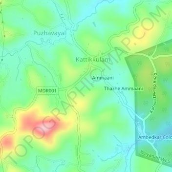
Name: Kattikulam topographic map, elevation, terrain.
Location: Kattikulam, Kattikkulam, Mananthavady, Wayanad, Kerala, India (11.82762 76.05058 11.85789 76.07048)
Average elevation: 772 m
Minimum elevation: 716 m
Maximum elevation: 894 m
Thank you for supporting this site ❤️
Make a donation
Make a donation
Gear up for your next adventure:
As an Amazon Associate, this site earns from qualifying purchases at no extra cost to you.