
McClelland topographic map
Interactive map
Click on the map to display elevation.
About this map
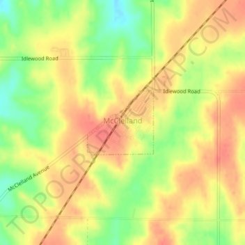
Name: McClelland topographic map, elevation, terrain.
Location: McClelland, Pottawattamie County, Iowa, United States (41.32567 -95.68925 41.33270 -95.67954)
Average elevation: 369 m
Minimum elevation: 335 m
Maximum elevation: 390 m
Other topographic maps
Click on a map to view its topography, its elevation and its terrain.
Avoca
United States > Iowa > Pottawattamie County
Avoca, Pottawattamie County, Iowa, 51521, United States
Average elevation: 353 m
Bentley
United States > Iowa > Pottawattamie County
Bentley, Pottawattamie County, Iowa, 51548, United States
Average elevation: 368 m
Underwood
United States > Iowa > Pottawattamie County
Underwood, Pottawattamie County, Iowa, United States
Average elevation: 339 m