Geolocate

Tapoco topographic map

Click on the map to display elevation.

About this map

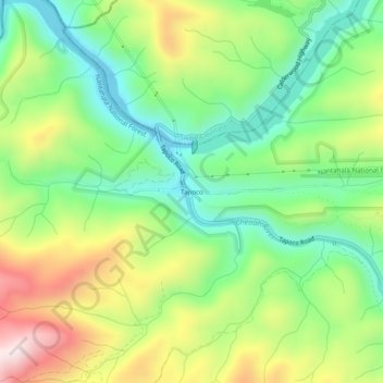
Name: Tapoco topographic map, elevation, terrain.

Location: Tapoco, Graham County, North Carolina, United States (35.42342 -83.95685 35.46342 -83.91685)

Average elevation: 537 m

Minimum elevation: 329 m

Maximum elevation: 865 m

Other topographic maps

Click on a map to view its topography, its elevation and its terrain.

Gear up for your next adventure:

🧥Waterproof Jacket - Lightweight rain jackets for hiking and outdoor activities
Lightweight Backpacking Tent - Compact tent for efficient hiking trips
🧭GPS Tracker - Track your location in remote areas safely
🥾Mountain Hiking Shoes - Shoes with superior grip for mountainous terrain
👟Trail Running Shoes - Agile footwear for fast-paced topographic exploration

As an Amazon Associate, this site earns from qualifying purchases at no extra cost to you.