Geolocate

Styal topographic map

Click on the map to display elevation.

About this map
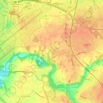
Name: Styal topographic map, elevation, terrain.

Location: Styal, Cheshire East, England, United Kingdom (53.33711 -2.28066 53.36113 -2.22428)

Average elevation: 76 m

Minimum elevation: 43 m

Maximum elevation: 89 m

Gear up for your next adventure:

🔥Emergency Fire Starter - Reliable ignition source for all weather conditions
🥾Durable Hiking Shoes - Long-lasting shoes for frequent hiking
🧴Waterproofing Spray - Restore the DWR coating on jackets and tents
🧊Portable Cooler - Keep food and drinks cold during outdoor adventures
🪑Insulated Seat Pad - Protect your seat from cold rocks and wet logs

As an Amazon Associate, this site earns from qualifying purchases at no extra cost to you.