Geolocate

Hempstead topographic map

Click on the map to display elevation.

About this map

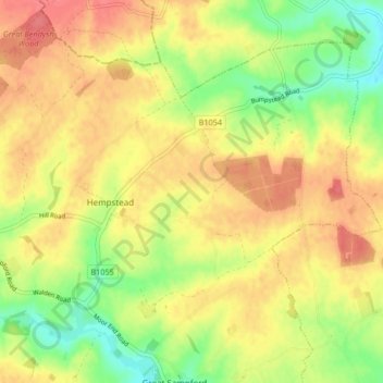
Name: Hempstead topographic map, elevation, terrain.

Location: Hempstead, Uttlesford, Essex, England, United Kingdom (51.99915 0.35450 52.03914 0.43773)

Average elevation: 101 m

Minimum elevation: 67 m

Maximum elevation: 126 m

Gear up for your next adventure:

🔦UV Flashlight - Detect minerals or specific insects in the dark
Camping Groundsheet - Protect your tent from moisture and dirt
🚲Handlebar Phone Mount - View topographic-map.com live while cycling
🔭Outdoor Binoculars - Lightweight binoculars for birdwatching and hiking
🧦Crew Hiking Socks - Comfortable socks for long-distance hikes

As an Amazon Associate, this site earns from qualifying purchases at no extra cost to you.