Geolocate

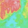
Lac-Labrie topographic map

Click on the map to display elevation.

About this map

Name: Lac-Labrie topographic map, elevation, terrain.

Location: Lac-Labrie, Sept-Îles, Sept-Rivières, Côte-Nord, Québec, Canada (50.16557 -66.70659 50.20557 -66.66659)

Average elevation: 101 m

Minimum elevation: 38 m

Maximum elevation: 276 m

Other topographic maps

Click on a map to view its topography, its elevation and its terrain.
Lac Pioui

Canada > Québec > Sept-Rivières > Sept-Îles

Average elevation: 128 m

Lac des Rapides

Canada > Québec > Sept-Rivières > Sept-Îles

Average elevation: 199 m

Lac à l'Anguille

Canada > Québec > Sept-Rivières > Sept-Îles

Average elevation: 91 m

Rivière Pigou

Canada > Québec > Sept-Rivières > Sept-Îles

Average elevation: 59 m

Gear up for your next adventure:

🧢Hiking Hat - Sun-protective and breathable hats for long treks
🔭Compact Monocular - One-handed bird watching and trail spotting
💧Collapsible Water Bottle - Space-saving water bottle for outdoor activities
🧭Orienteering Kit - Tools for map reading and navigation in the wild
🛶Waterproof Dry Bags - Keep electronics and clothes dry during river crossings

As an Amazon Associate, this site earns from qualifying purchases at no extra cost to you.