Geolocate

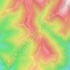
Crasna topographic map

Click on the map to display elevation.

About this map

Name: Crasna topographic map, elevation, terrain.

Location: Crasna, Gorj, Romania (45.10800 23.47183 45.35308 23.63270)

Average elevation: 937 m

Minimum elevation: 275 m

Maximum elevation: 2,502 m

Other topographic maps

Click on a map to view its topography, its elevation and its terrain.

Totea

Romania > Gorj

Average elevation: 333 m

Artanu

Romania > Gorj

Average elevation: 246 m

Urdele

Romania > Gorj > Novaci

Average elevation: 1,932 m

Costeni

Romania > Gorj > Tismana

Average elevation: 267 m

Costești

Romania > Gorj

Average elevation: 227 m

Bolboasa

Romania > Gorj

Average elevation: 219 m

Slăvuța

Romania > Gorj

Average elevation: 262 m

Cornetu

Romania > Gorj

Average elevation: 236 m

Păjiștele

Romania > Gorj

Average elevation: 375 m

Rânca

Romania > Gorj

Average elevation: 1,472 m

Gear up for your next adventure:

🔭Outdoor Binoculars - Lightweight binoculars for birdwatching and hiking
🪑Ultralight Camping Stool - Compact seating for rest stops during long hikes
💡Portable Camping Lamp - Rechargeable lamp for campsite lighting
🥾Approach Shoes - Shoes designed for climbing approaches and rugged trails
🦌Outdoor Trail Camera - Monitor wildlife activity near your favorite spots

As an Amazon Associate, this site earns from qualifying purchases at no extra cost to you.