Geolocate

Paligawan topographic map

Click on the map to display elevation.

About this map
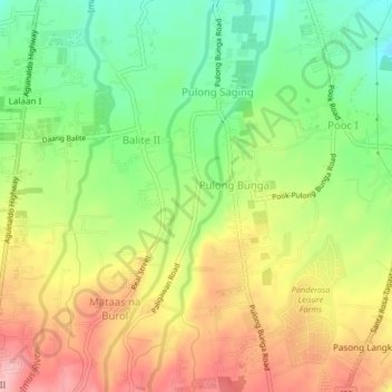
Name: Paligawan topographic map, elevation, terrain.

Location: Paligawan, Silang, Cavite, Calabarzon, 4118, Philippines (14.15752 120.95992 14.19752 120.99992)

Average elevation: 413 m

Minimum elevation: 341 m

Maximum elevation: 491 m

Other topographic maps

Click on a map to view its topography, its elevation and its terrain.
Carmen

Philippines > Cavite > Silang

Average elevation: 172 m

Carmen

Philippines > Cavite > Silang

Average elevation: 172 m

Carmen

Philippines > Cavite > Silang

Average elevation: 172 m

Gear up for your next adventure:

🐕Hiking Dog Pack - Let your canine companion carry their own water and food
🧭GPS Tracker - Track your location in remote areas safely
💡LED Camping Lantern - Illuminate your campsite with long-lasting lanterns
🧴Bear Spray Holster - Quick-access carry for essential Canadian wilderness safety
🥾Hiking Shorts - Breathable shorts suitable for summer hikes

As an Amazon Associate, this site earns from qualifying purchases at no extra cost to you.