Geolocate

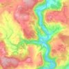
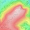
Llandenny topographic map

Click on the map to display elevation.

About this map

Name: Llandenny topographic map, elevation, terrain.

Location: Llandenny, Monmouthshire, Wales, NP15 1DL, United Kingdom (51.71056 -2.86750 51.75056 -2.82750)

Average elevation: 44 m

Minimum elevation: 18 m

Maximum elevation: 115 m

Other topographic maps

Click on a map to view its topography, its elevation and its terrain.
Llanbadoc

United Kingdom > Wales > Monmouthshire

Average elevation: 78 m

Wye Valley

United Kingdom > Wales > Monmouthshire

Average elevation: 167 m

Penallt

United Kingdom > Wales > Monmouthshire

Average elevation: 174 m

Crucorney

United Kingdom > Wales > Monmouthshire

Average elevation: 297 m

Blorenge

United Kingdom > Wales > Monmouthshire > Govilon

Average elevation: 394 m

River Monnow

United Kingdom > Wales > Monmouthshire

Average elevation: 172 m

River Monnow

United Kingdom > Wales > Monmouthshire

Average elevation: 172 m

Raglan Castle

United Kingdom > Wales > Monmouthshire > Raglan

Average elevation: 59 m

Gear up for your next adventure:

🛶Kayak Dry Bag - Waterproof storage for kayaking adventures
🦯Trekking Poles - Reduced impact on joints for steep topographic climbs
🥾Hiking Shorts - Breathable shorts suitable for summer hikes
🧥Fleece Jacket - Warm and lightweight jacket for layering
🧭GPS Outdoor Watch - Smart watch for navigation and fitness tracking in nature

As an Amazon Associate, this site earns from qualifying purchases at no extra cost to you.