Geolocate

Neuville topographic map

Click on the map to display elevation.

About this map
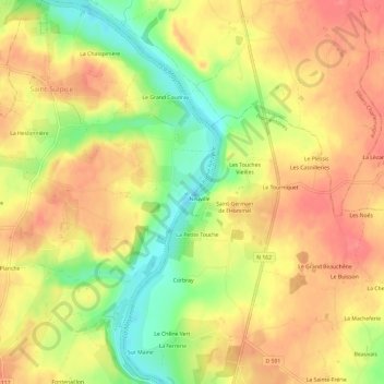
Name: Neuville topographic map, elevation, terrain.

Location: Neuville, Saint-Sulpice, La Roche-Neuville, Château-Gontier, Mayenne, Pays de la Loire, France métropolitaine, 53360, France (47.87018 -0.71404 47.91018 -0.67404)

Average elevation: 69 m

Minimum elevation: 28 m

Maximum elevation: 95 m

Other topographic maps

Click on a map to view its topography, its elevation and its terrain.
Gear up for your next adventure:

📷Outdoor Action Camera - Capture high-elevation views and rugged adventures
🔨Vehicle Emergency Tool - Safety tool for remote road trips to trailheads
💡Solar Camping Lamp - Eco-friendly lighting for campsites
🧶550 Survival Paracord - Versatile utility cord for emergency repairs and rigging
🧢Outdoor Visor - Breathable visor for sunny hikes

As an Amazon Associate, this site earns from qualifying purchases at no extra cost to you.