Geolocate

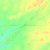
Spiceland topographic map

Click on the map to display elevation.

About this map

Name: Spiceland topographic map, elevation, terrain.

Location: Spiceland, Henry County, Indiana, United States (39.83104 -85.44844 39.84204 -85.42948)

Average elevation: 323 m

Minimum elevation: 300 m

Maximum elevation: 340 m

Other topographic maps

Click on a map to view its topography, its elevation and its terrain.
Messick

United States > Indiana > Henry County

Average elevation: 334 m

Westwood

United States > Indiana > Henry County

Average elevation: 319 m

Gear up for your next adventure:

👖Convertible Hiking Pants - Zip-off legs to adapt to changing weather conditions
🎒Fully Waterproof Backpack - Total protection for photography gear and electronics
💡Compact LED Flashlight - Powerful and portable flashlight for outdoor use
🧢Outdoor Cap - Protective cap for sun and rain during hikes
🎒Hiking Backpack - Lightweight and ergonomic backpacks for day hikes or multi-day treks

As an Amazon Associate, this site earns from qualifying purchases at no extra cost to you.