Geolocate

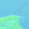
Gwaenysgor topographic map

Click on the map to display elevation.

About this map

Name: Gwaenysgor topographic map, elevation, terrain.

Location: Gwaenysgor, Flintshire, Wales, LL18 6EJ, United Kingdom (53.29835 -3.41040 53.33835 -3.37040)

Average elevation: 111 m

Minimum elevation: 3 m

Maximum elevation: 239 m

Other topographic maps

Click on a map to view its topography, its elevation and its terrain.

Nannerch

United Kingdom > Wales > Flintshire > Nannerch

Average elevation: 232 m

Ewloe Castle

United Kingdom > Wales > Flintshire > Ewloe

Average elevation: 74 m

Penyffordd

United Kingdom > Wales > Flintshire

Average elevation: 101 m

Bagilt Reservior

United Kingdom > Wales > Flintshire > Bagillt

Average elevation: 32 m

Wepre Park

United Kingdom > Wales > Flintshire > Connah's Quay

Average elevation: 46 m

Saltney

United Kingdom > Wales > Flintshire

Average elevation: 9 m

Point of Ayr

United Kingdom > Wales > Flintshire > Talacre

Average elevation: 2 m

Gear up for your next adventure:

💡Solar Camping Lamp - Eco-friendly lighting for campsites
🧊Insulated Water Bottle - Keeps drinks cold in summer and prevents freezing in winter
🧴Waterproofing Spray - Restore the DWR coating on jackets and tents
🥾Trail Running Boots - Durable shoes designed for trail running
🥾Waterproof Hiking Shoes - Durable shoes for wet and rugged trails

As an Amazon Associate, this site earns from qualifying purchases at no extra cost to you.