Geolocate

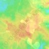
Moustier topographic map

Click on the map to display elevation.

About this map

Name: Moustier topographic map, elevation, terrain.

Location: Moustier, Marmande, Lot-et-Garonne, Nouvelle-Aquitaine, Metropolitan France, 47800, France (44.62893 0.27606 44.65875 0.32760)

Average elevation: 71 m

Minimum elevation: 35 m

Maximum elevation: 126 m

Other topographic maps

Click on a map to view its topography, its elevation and its terrain.
Marry

France > Nouvelle-Aquitaine > Lot-et-Garonne > Veyries > Saint-Gény

Average elevation: 127 m

Message

France > Nouvelle-Aquitaine > Lot-et-Garonne > Antagnac

Average elevation: 144 m

Sous Chays

France > Nouvelle-Aquitaine > Lot-et-Garonne > Pujols

Average elevation: 102 m

Gear up for your next adventure:

⛺Camping Essentials - All-in-one gear for a comfortable camping trip
🧢Hiking Hat - Sun-protective and breathable hats for long treks
🥾Mountaineering Boots - Supportive boots for climbing and high-altitude hiking
🥾Light Hiking Boots - Lightweight and comfortable boots for day hikes
🛶Canoe Life Vest - Safety vest for water sports

As an Amazon Associate, this site earns from qualifying purchases at no extra cost to you.