Geolocate

Chester topographic map

Click on the map to display elevation.

About this map

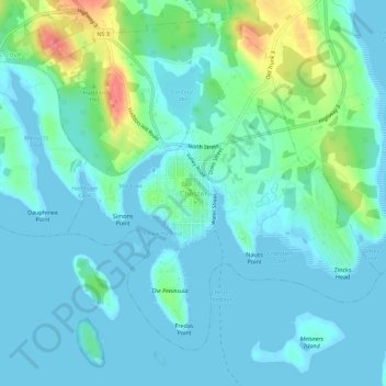
Name: Chester topographic map, elevation, terrain.

Location: Chester, Lunenburg County, Nova Scotia, B0J 1J0, Canada (44.52133 -64.26119 44.56133 -64.22119)

Average elevation: 14 m

Minimum elevation: -5 m

Maximum elevation: 73 m

Nova Scotia trails, hiking, mountain biking, running and outdoor activities

Gear up for your next adventure:

🥽Outdoor Goggles - Protective eyewear for outdoor activities
Camping Essentials - All-in-one gear for a comfortable camping trip
👟Leg Gaiters - Keep debris, mud, and snow out of your boots
🔦LED Headlamp - Hands-free lighting for early morning starts or late finishes
🦶Anti-Blister Balm - Prevents friction and hotspots during long ascents

As an Amazon Associate, this site earns from qualifying purchases at no extra cost to you.