
Thank you for supporting this site ❤️
Make a donation
Make a donation
Gear up for your next adventure:
As an Amazon Associate, this site earns from qualifying purchases at no extra cost to you.
Abi topographic map
Click on the map to display elevation.
Thank you for supporting this site ❤️
Make a donation
Make a donation
Gear up for your next adventure:
As an Amazon Associate, this site earns from qualifying purchases at no extra cost to you.
About this map
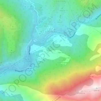
Name: Abi topographic map, elevation, terrain.
Location: Abi, Seira, Ribagorza, Huesca, Aragon, Spain (42.45085 0.41034 42.49085 0.45034)
Average elevation: 1,135 m
Minimum elevation: 753 m
Maximum elevation: 2,074 m
Thank you for supporting this site ❤️
Make a donation
Make a donation
Gear up for your next adventure:
As an Amazon Associate, this site earns from qualifying purchases at no extra cost to you.