
Hobrede topographic map
Interactive map
Click on the map to display elevation.
About this map
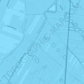
Name: Hobrede topographic map, elevation, terrain.
Location: Hobrede, Edam-Volendam, Nordholland, Niederlande (52.53550 4.96881 52.55381 4.99932)
Average elevation: -2 m
Minimum elevation: -6 m
Maximum elevation: 2 m
Other topographic maps
Click on a map to view its topography, its elevation and its terrain.
Oosthuizen
Niederlande > Nordholland > Edam-Volendam
Oosthuizen, Edam-Volendam, Nordholland, Niederlande
Average elevation: -1 m