Geolocate

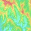
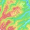
Luka topographic map

Click on the map to display elevation.

About this map

Name: Luka topographic map, elevation, terrain.

Location: Luka, Općina Luka, Zagreb County, 10296, Croatia (45.93914 15.80751 45.97206 15.83296)

Average elevation: 151 m

Minimum elevation: 129 m

Maximum elevation: 221 m

Other topographic maps

Click on a map to view its topography, its elevation and its terrain.
Beder

Croatia > Zagreb County > Grad Samobor

Average elevation: 414 m

Dubranec

Croatia > Zagreb County > City of Velika Gorica

Average elevation: 177 m

Donja Drenova

Croatia > Zagreb County

Average elevation: 215 m

Dubranec

Croatia > Zagreb County > City of Velika Gorica

Average elevation: 177 m

Prigorje Brdovečko

Croatia > Zagreb County

Average elevation: 161 m

Vernari

Croatia > Zagreb County > Gornji Stupnik

Average elevation: 129 m

Trstenik

Croatia > Zagreb County

Average elevation: 200 m

Gear up for your next adventure:

🛶Kayak Accessories - Essential gear for safe and fun kayaking adventures
☕Camping Coffee Maker - Brew fresh coffee anywhere on the topographic map
🧦Hiking Socks - Moisture-wicking and comfortable socks for long hikes
🧢Outdoor Cap - Protective cap for sun and rain during hikes
🧭Orienteering Kit - Tools for map reading and navigation in the wild

As an Amazon Associate, this site earns from qualifying purchases at no extra cost to you.