Geolocate

Amphitheatre topographic map

Click on the map to display elevation.

About this map

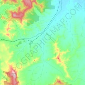
Name: Amphitheatre topographic map, elevation, terrain.

Location: Amphitheatre, Shire of Pyrenees, Victoria, 3468, Australia (-37.26929 143.31655 -37.13132 143.50604)

Average elevation: 373 m

Minimum elevation: 242 m

Maximum elevation: 781 m

Gear up for your next adventure:

🧦Hiking Liner Socks - Thin base layer to prevent friction and blisters
🧴Outdoor Sunscreen - High SPF protection for high-altitude UV exposure
🥤Collapsible Travel Cup - Saves space and weight in your mess kit
🧊Insulated Water Bottle - Keeps drinks cold in summer and prevents freezing in winter
Camping Tent - Weather-resistant tents suitable for 2 to 6 people

As an Amazon Associate, this site earns from qualifying purchases at no extra cost to you.