Geolocate

Aliaga topographic map

Click on the map to display elevation.

About this map

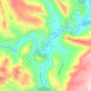
Name: Aliaga topographic map, elevation, terrain.

Location: Aliaga, Cuencas Mineras, Teruel, Aragon, 44150, Spain (40.65357 -0.72317 40.69357 -0.68317)

Average elevation: 1,236 m

Minimum elevation: 1,080 m

Maximum elevation: 1,440 m

Gear up for your next adventure:

Backpacking Tent - Lightweight tent for long-distance hiking trips
🔋Lithium AA Batteries - Long-lasting power that performs in extreme cold
🦯Trekking Poles - Reduced impact on joints for steep topographic climbs
🔭Compact Monocular - One-handed bird watching and trail spotting
🔦UV Flashlight - Detect minerals or specific insects in the dark

As an Amazon Associate, this site earns from qualifying purchases at no extra cost to you.