
Tibberton topographic map
Click on the map to display elevation.
About this map
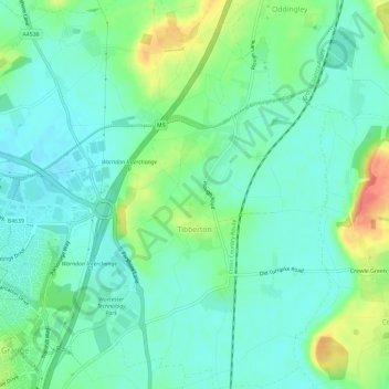
Name: Tibberton topographic map, elevation, terrain.
Location: Tibberton, Wychavon, Worcestershire, England, United Kingdom (52.19633 -2.16489 52.23206 -2.12411)
Average elevation: 50 m
Minimum elevation: 33 m
Maximum elevation: 90 m
Other topographic maps
Click on a map to view its topography, its elevation and its terrain.
Atch Lench
United Kingdom > England > Worcestershire > Wychavon > Church Lench
Average elevation: 80 m
Badsey Lane Nature Reserve
United Kingdom > England > Worcestershire > Wychavon > Evesham
Average elevation: 37 m