Geolocate

Broxted topographic map

Click on the map to display elevation.

About this map

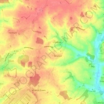
Name: Broxted topographic map, elevation, terrain.

Location: Broxted, Uttlesford, Essex, England, United Kingdom (51.89155 0.26485 51.95221 0.32154)

Average elevation: 100 m

Minimum elevation: 59 m

Maximum elevation: 127 m

Gear up for your next adventure:

🧰Survival Kit - Essential gear for emergencies in the wilderness
🧢Beanie Hat - Keep your head warm in cold weather
🧴Outdoor Sunscreen - High SPF protection for high-altitude UV exposure
Camping Tent - Weather-resistant tents suitable for 2 to 6 people
🧰Multitool Knife - Compact and versatile tool for outdoor use

As an Amazon Associate, this site earns from qualifying purchases at no extra cost to you.