Geolocate

Simsbury topographic map

Click on the map to display elevation.

About this map
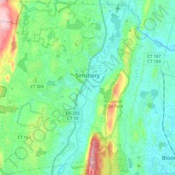
Name: Simsbury topographic map, elevation, terrain.

Location: Simsbury, Hartford County, Connecticut, United States (41.81614 -72.87726 41.92071 -72.75871)

Average elevation: 87 m

Minimum elevation: 28 m

Maximum elevation: 289 m

Gear up for your next adventure:

💧Hydration Pack - Hands-free hydration system for long hikes
🚲Handlebar Phone Mount - View topographic-map.com live while cycling
⛺Camping Groundsheet - Protect your tent from moisture and dirt
🥾Trail Running Boots - Durable shoes designed for trail running
🍽️Titanium Camping Spork - Ultralight and indestructible eating utensil

As an Amazon Associate, this site earns from qualifying purchases at no extra cost to you.