Geolocate

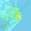
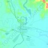
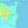
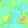
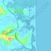
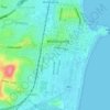
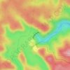
Fingal topographic map

Click on the map to display elevation.

About this map

Name: Fingal topographic map, elevation, terrain.

Location: Fingal, Tweed Shire Council, New South Wales, 2485, Australia (-28.22051 153.54648 -28.18051 153.58648)

Average elevation: 3 m

Minimum elevation: -3 m

Maximum elevation: 57 m

Other topographic maps

Click on a map to view its topography, its elevation and its terrain.
Sydney

Australia > New South Wales

Sydney's topography is characterized by a diverse landscape that seamlessly blends coastal features with inland plateaus. The city is divided into two primary regions: the relatively flat Cumberland Plain to the south and west of Sydney Harbour, and the elevated Hornsby Plateau to the north. The Cumberland…

Average elevation: 51 m
Orange

Australia > New South Wales

Orange is a city in the Central Tablelands region of New South Wales, Australia. It is 254 km (158 mi) west of the state capital, Sydney [206 km (128 mi) on a great circle], at an altitude of 862 metres (2,828 ft). Orange had an estimated urban population of 40,493 as of June 2018 making the city a significant…

Average elevation: 852 m
Newcastle

Australia > New South Wales > Newcastle

Average elevation: 5 m

Bowral

Australia > New South Wales

Average elevation: 690 m

Port Macquarie

Australia > New South Wales

Average elevation: 5 m

Wagga Wagga

Australia > New South Wales

Average elevation: 183 m

Yass

Australia > New South Wales

Yass is located 280 km south-west of Sydney, on the Hume Highway. The Yass River, which is a tributary of the Murrumbidgee River, flows through the town. Yass is 59 km from Canberra; lying at an elevation of 505 m AMSL.

Average elevation: 533 m
Barrington Tops

Australia > New South Wales

Average elevation: 1,107 m

Singleton Council

Australia > New South Wales

Average elevation: 238 m

Terrigal

Australia > New South Wales

Average elevation: 13 m

Glen Innes

Australia > New South Wales

Average elevation: 1,083 m

Mullumbimby

Australia > New South Wales

Average elevation: 29 m

Hornsby

Australia > New South Wales > Sydney

Average elevation: 160 m

Shoalhaven River

Australia > New South Wales

Average elevation: 453 m

Corndale

Australia > New South Wales

Average elevation: 81 m

Delegate

Australia > New South Wales

Average elevation: 841 m

Gerroa

Australia > New South Wales

Average elevation: 7 m

Broken Hill

Australia > New South Wales

Average elevation: 142 m

Crookwell

Australia > New South Wales

Crookwell is a small town located in the Southern Tablelands of New South Wales, Australia, in the Upper Lachlan Shire. At the 2016 census, Crookwell had a population of 2,641. The town is at a relatively high altitude of 887 metres and there are several snowfalls during the winter months. The nearest major…

Average elevation: 904 m
Moruya

Australia > New South Wales

Average elevation: 37 m

Penrith

Australia > New South Wales > Sydney > Penrith

Penrith is a city in New South Wales, Australia, located in Greater Western Sydney, 55 kilometres (31 mi) west of the Sydney central business district on the banks of the Nepean River, on the outskirts of the Cumberland Plain. Its elevation is 32 metres (105 ft).

Average elevation: 34 m
Balmain

Australia > New South Wales > Sydney

Average elevation: 12 m

Casino

Australia > New South Wales

Average elevation: 32 m

Mudgee

Australia > New South Wales

Average elevation: 535 m

Coogee

Australia > New South Wales

Average elevation: 35 m

Riverwood

Australia > New South Wales > Sydney

Average elevation: 22 m

Sydney

Australia > New South Wales > Sydney

Average elevation: 23 m

Beverly Hills

Australia > New South Wales > Sydney

Average elevation: 40 m

Silverdale

Australia > New South Wales > Sydney

Average elevation: 149 m

Boggabri

Australia > New South Wales

Average elevation: 301 m

Deer Vale

Australia > New South Wales

Average elevation: 1,017 m

Worrigee

Australia > New South Wales

Average elevation: 22 m

Mororo

Australia > New South Wales

Average elevation: 35 m

Moruya Heads

Australia > New South Wales

Average elevation: 9 m

Beacon Hill

Australia > New South Wales > Sydney

Average elevation: 91 m

Goonengerry

Australia > New South Wales

Average elevation: 152 m

Glenbrook

Australia > New South Wales

Average elevation: 168 m

Parramatta

Australia > New South Wales

Average elevation: 22 m

Goulburn

Australia > New South Wales

Owing to its elevation, Goulburn has an oceanic climate (Cfb) with warm summers and cool winters; with a high diurnal range. Its climate is variable much of the year, though generally dry with maximum temperatures ranging from 11.8 °C (53.2 °F) in July to 28.3 °C (82.9 °F) in January. Rainfall is…

Average elevation: 666 m

Byron Bay

Australia > New South Wales

Byron Bay, located in northeastern New South Wales, Australia, is characterized by diverse topography shaped by its geological history. The town is part of the erosion caldera of the ancient Tweed Volcano, which erupted approximately 23 million years ago, resulting in the rich volcanic soils that define the…

Average elevation: 7 m

Mittagong

Australia > New South Wales

Average elevation: 672 m

Manly

Australia > New South Wales

Average elevation: 17 m

Taree

Australia > New South Wales

Average elevation: 17 m

Murwillumbah

Australia > New South Wales

Average elevation: 7 m

Maroubra

Australia > New South Wales

Average elevation: 27 m

Wauchope

Australia > New South Wales

Average elevation: 32 m

Ocean Shores

Australia > New South Wales

Average elevation: 12 m

Prestons

Australia > New South Wales

Average elevation: 37 m

Stanwell Tops

Australia > New South Wales

Average elevation: 187 m

Glen Davis

Australia > New South Wales

Average elevation: 619 m

Balmoral Village

Australia > New South Wales

Average elevation: 442 m

Moama

Australia > New South Wales

Average elevation: 96 m

Empire Bay

Australia > New South Wales

Average elevation: 21 m

Blue Mountains

Australia > New South Wales

A sandstone plateau dominated by a landscape of endless eucalyptus forests, the Blue Mountains are located at the top of a 470-million-year-old quartzite. In the Permian period, a shallow sea covered the region, when rivers brought shales, siltstones and mudstones. Then during the Mesozoic period, rivers…

Average elevation: 566 m

Adaminaby

Australia > New South Wales

Another site 20 km to the north (Yaouk, since 1969) records significantly greater rainfall due to its higher elevation and proximity to the dividing range. This site is most representative of the areas situated on and around Lake Eucumbene. Rainfall total and pattern here approach those of Khancoban and very…

Average elevation: 1,174 m

King Creek

Australia > New South Wales

Average elevation: 35 m

Lovedale

Australia > New South Wales

Average elevation: 75 m

Nabiac

Australia > New South Wales

Average elevation: 42 m

Clunes

Australia > New South Wales

Average elevation: 60 m

Darawank

Australia > New South Wales

Average elevation: 5 m

Karuah

Australia > New South Wales

Average elevation: 21 m

Mount Victoria

Australia > New South Wales

Mount Victoria (postcode: 2786) is a small township in the Blue Mountains of New South Wales, Australia. Mount Victoria is geographically the western most village and suburb of Greater Sydney on the great western highway in the City of Blue Mountains, located about 120 kilometres (75 mi) west-northwest by road…

Average elevation: 901 m

Bullio

Australia > New South Wales

Average elevation: 503 m

Cooranbong

Australia > New South Wales

Average elevation: 72 m

Mullumbimby Creek

Australia > New South Wales

Average elevation: 51 m

Carlingford

Australia > New South Wales > Sydney

Average elevation: 98 m

Tahmoor

Australia > New South Wales

Average elevation: 269 m

Swansea

Australia > New South Wales

Average elevation: 7 m

Pitt Town

Australia > New South Wales > Sydney

Average elevation: 19 m

Asquith

Australia > New South Wales

Average elevation: 168 m

Casula

Australia > New South Wales > Sydney

Casula is the first suburb immediately south of Liverpool on the Hume Highway and the Main Southern railway line between Sydney and Melbourne. Casula consists of undulating, gently rolling land, with elevations across the suburb being mostly between 30 and 70 metres above sea level. The Georges River forms the…

Average elevation: 34 m
Illawarra

Australia > New South Wales

Average elevation: 234 m

Tweed Shire Council

Australia > New South Wales

Average elevation: 212 m

Gerringong

Australia > New South Wales

Average elevation: 37 m

Mid-Coast Council

Australia > New South Wales

Average elevation: 278 m

Merimbula

Australia > New South Wales

Average elevation: 22 m

Copeton Dam

Australia > New South Wales

Average elevation: 558 m

Jindabyne

Australia > New South Wales

Average elevation: 1,077 m

Termeil

Australia > New South Wales

Average elevation: 73 m

Queenscliff

Australia > New South Wales > Sydney

Average elevation: 14 m

Wollongong

Australia > New South Wales

Average elevation: 16 m

Bumbaldry

Australia > New South Wales

Average elevation: 485 m

Mount Tomah

Australia > New South Wales

Average elevation: 720 m

Eccleston

Australia > New South Wales

Average elevation: 293 m

Woronora Dam

Australia > New South Wales

The wall of Woronora Dam is an engineering work imbued with a sense of high aesthetic value expressed through the long curved high wall set with the wide valley of the Woronora River. Upstream of the dam wall this setting is characterised by the broad expanse of the pool of water bordered by the crests of the…

Average elevation: 198 m

Mooball

Australia > New South Wales

Average elevation: 61 m

Cooplacurripa

Australia > New South Wales

Average elevation: 501 m

Shoalhaven Heads

Australia > New South Wales

Average elevation: 5 m

Walcha Council

Australia > New South Wales

Average elevation: 867 m

Gear up for your next adventure:

🥾All-Terrain Hiking Boots - Versatile boots for varied hiking conditions
🌬️Windproof Camp Stove - Efficient cooking even on exposed mountain peaks
💧Hydration Bladder - Hands-free hydration solution for long treks
🧭GPS Handheld Device - Reliable GPS navigation for outdoor adventures
🍽️Titanium Camping Spork - Ultralight and indestructible eating utensil

As an Amazon Associate, this site earns from qualifying purchases at no extra cost to you.